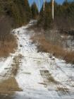
1
Looking west towards Priceville along the closed portion of the road2010
Old Durham Road, Priceville, Ontario, Canada
 Credits:
South Grey Museum, Flesherton, ON
2
North American location map2011
Priceville, Ontario, Canada
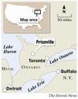 Credits:
The Detroit News
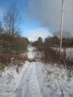
3
The road looking east from Priceville2010
Old Durham Road, Priceville, Ontario, Canada
 Credits:
South Grey Museum, Flesherton, ON
4
The shot looks westward, across the Suageen River to Priceville. The road continues on the other side, meeting Grey County Road #4 just beyond the village, where it continues (as Grey County #4) all the way into Durham.In the 19th century, there was a bridge across the river at this location.
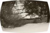
5
Looking towards Priceville2010
Old Durham Road, Priceville, Ontario, Canada
 Credits:
South Grey Museum, Flesherton, ON
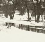
6
Where the ODR meets the Saugeen River, Priceville2010
Old Durham Road, Priceville, Ontario, Canada
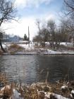 Credits:
South Grey Museum, Flesherton, ON
7
Looking eastward from Priceville, towards the cemetery2010
Old Durham Road, Priceville, Ontario, Canada
 Credits:
South Grey Museum, Flesherton, ON
8
The Commercial Hotel, Priceville, c. 18901890
Priceville, Ontario, Canada
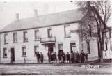 Credits:
Priceville and its Roots / Routes
9
Commercial Hotel Priceville - today1 March 2012
Priceville, Ontario, Canada
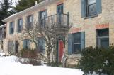 Credits:
South Grey Museum, Flesherton, ON
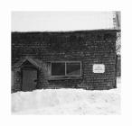
10
Shingles (old Priceville)2012
Priceville, Ontario, Canada
 Credits:
South Grey Museum, Flesherton, ON
11
Blacksmith - old Priceville1882
Priceville, Ontario, Canada
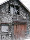 Credits:
South Grey Museum, Flesherton, ON
12
Blacksmith - Priceville1882
Priceville, Ontario, Canada
 Credits:
South Grey Museum, Flesherton, ON
13
Saugeen River, Priceville2012
Priceville, Ontario, Canada
 Credits:
South Grey Museum, Flesherton, ON
14
Overhead shot of Saugeen River2012
Priceville, Ontario, Canada
 Credits:
South Grey Museum, Flesherton, ON