27
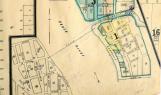
This 1916 map shows the streetplan of the west side of Peace River Crossing (to the left hand side of the map) and the area south of the Heart River (to the right side of the map). A few years earlier both of these areas had almost no development on them and large portions of these areas were still used for animal grazing. Both areas were mixed in terms of being both residential and commercial in nature.28
The 1916 streetplan for the western and southern parts of Peace River Crossing.1916
Peace River Crossing, Alberta
 Credits:
PRMA/MC 77.833.79